Hike Length: 5-7km
Terrain: This is a well marked trail with just under 100m of elevation that should be suitable for all hikers.
Estimated time to complete: 4 hours with breaks and exploration time. (We may shorten the hike depending on how tired the puppies legs get).
Additional information: This hike is made possible by the amazing people at Carter's Forever Rescue. A portion of the cost of the trip will be donated to their organization to support them in their goal of finding good forever homes for dogs in need.
07:20 - Meet at PetroCanada next to Keele Subway Station. There's free parking on Keele Street north of the station.
07:30 - Van leaves. Please note that we'll be leaving dead on 8 and can't wait for latecomers so please, please be on time!
10:00 - Meet self drivers at Bracebridge Resource Management Centre. We can't wait for self drivers so please be on time.
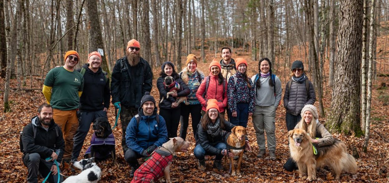
10:00 - 13:30 - Hike with the rescue dogs
13:30 - 15:30- Return from Hike, visit High Falls
18:00 - Anticipated return to Keele Station
This custom map is georeferenced, meaning it will show you where you are on the map in the right software and lays out the rough path that we’ll be following. It’s opened with the Avenza app which must be downloaded and installed in advance of the adventure.
You should also download the What3words app - this makes it easy to share and find locations in the unlikely event that you get lost.
Shoes
Hiking boots are highly recommended, ideally ones with high ankle support to prevent injuries.
Blaze/Hunter Orange (highly encouraged)
Hunting is a fact of life in winter in many of the places we visit. Most of this activity occurs far away from where we'll be hiking but out of an abundance of caution, you should always bring some blaze or 'hunter' orange clothing with you. This ensures that you are visible and prevents any (already incredibly unlikely) accidents from occurring.
Don't have something suitable? We have Wilderness Union branded hats in the bus that you can purchase!
Fall Hike Packing List
Have any questions? Reach out to us on Discord!
You should read all of the instructions in here carefully and make sure you've downloaded and installed the map! It's important that you listen to the guides and follow their instructions at all times.
Hiking injuries: This is not an easy hike- wear appropriate footwear (ankle high hiking boots) and hike within your abilities. If you need extra support, bring hiking poles. Always speak with a guide if you're concerned for your safety.
Getting lost: All hikers must remain with the group at all times. If you do find yourself lost at any point, stay where you are and call for help. If you have a whistle, bring it.
Trail conditions: Trails may be muddy and often have poor visibility. Ensure you're wearing proper footwear with tread and ankle support.
Wildlife: Wildlife may be in the area- remember to always exercise caution and notify guides immediately if you come across something.
Ticks - Ticks are active in the area we're visiting. Black Legged Ticks have the risk of carrying Lyme disease so it's important that you check yourself thoroughly after each hike. You're also recommended to have your legs covered so it's harder for them to latch on.
Hunting - While it's very unlikely anyone will be hunting on such a popular trail, it's technically permitted so you're strongly advised to wear an item of hunter orange clothing. Get your own WU toque here!
All of the areas we visit across Ontario are situated on lands with deep histories and ongoing connections to Indigenous Nations, whose mutual relationships date back to time immemorial. Often rooted in a deep respect for the land, these predate European colonization and offer values that we strive to follow.
At Wilderness Union, we recognize that being on these lands carries a responsibility to learn and reflect. We use the Native Land map to better understand the territories we explore. We’ve found that a deeper understanding of the land’s history leads to a more robust appreciation of our time in nature and a change to how we behave in it. We strongly encourage you to take a moment to explore the resources available on that site- there is a ton of fantastic information.
For this adventure specifically, we’ll be trekking through Muskoka and Bracebridge. These ares are on the traditional territory of the Anishinaabeg, which includes the Ojibwe (also known as Chippewa), Odawa, and Potawatomi peoples. It is part of the lands covered by the Williams Treaties.
Hike Length: 5-7km
Terrain: This is a well marked trail with just under 100m of elevation that should be suitable for all hikers.
Estimated time to complete: 4 hours with breaks and exploration time. (We may shorten the hike depending on how tired the puppies legs get).
Additional information: This hike is made possible by the amazing people at Carter's Forever Rescue. A portion of the cost of the trip will be donated to their organization to support them in their goal of finding good forever homes for dogs in need.
07:20 - Meet at PetroCanada next to Keele Subway Station. There's free parking on Keele Street north of the station.
07:30 - Van leaves. Please note that we'll be leaving dead on 8 and can't wait for latecomers so please, please be on time!
10:00 - Meet self drivers at Bracebridge Resource Management Centre. We can't wait for self drivers so please be on time.
10:00 - 13:30 - Hike with the rescue dogs
13:30 - 15:30- Return from Hike, visit High Falls
18:00 - Anticipated return to Keele Station
This custom map is georeferenced, meaning it will show you where you are on the map in the right software and lays out the rough path that we’ll be following. It’s opened with the Avenza app which must be downloaded and installed in advance of the adventure.
You should also download the What3words app - this makes it easy to share and find locations in the unlikely event that you get lost.
Shoes
Hiking boots are highly recommended, ideally ones with high ankle support to prevent injuries.
Blaze/Hunter Orange (highly encouraged)
Hunting is a fact of life in winter in many of the places we visit. Most of this activity occurs far away from where we'll be hiking but out of an abundance of caution, you should always bring some blaze or 'hunter' orange clothing with you. This ensures that you are visible and prevents any (already incredibly unlikely) accidents from occurring.
Don't have something suitable? We have Wilderness Union branded hats in the bus that you can purchase!
Fall Hike Packing List
Have any questions? Reach out to us on Discord!
You should read all of the instructions in here carefully and make sure you've downloaded and installed the map! It's important that you listen to the guides and follow their instructions at all times.
Hiking injuries: This is not an easy hike- wear appropriate footwear (ankle high hiking boots) and hike within your abilities. If you need extra support, bring hiking poles. Always speak with a guide if you're concerned for your safety.
Getting lost: All hikers must remain with the group at all times. If you do find yourself lost at any point, stay where you are and call for help. If you have a whistle, bring it.
Trail conditions: Trails may be muddy and often have poor visibility. Ensure you're wearing proper footwear with tread and ankle support.
Wildlife: Wildlife may be in the area- remember to always exercise caution and notify guides immediately if you come across something.
Ticks - Ticks are active in the area we're visiting. Black Legged Ticks have the risk of carrying Lyme disease so it's important that you check yourself thoroughly after each hike. You're also recommended to have your legs covered so it's harder for them to latch on.
Hunting - While it's very unlikely anyone will be hunting on such a popular trail, it's technically permitted so you're strongly advised to wear an item of hunter orange clothing. Get your own WU toque here!
All of the areas we visit across Ontario are situated on lands with deep histories and ongoing connections to Indigenous Nations, whose mutual relationships date back to time immemorial. Often rooted in a deep respect for the land, these predate European colonization and offer values that we strive to follow.
At Wilderness Union, we recognize that being on these lands carries a responsibility to learn and reflect. We use the Native Land map to better understand the territories we explore. We’ve found that a deeper understanding of the land’s history leads to a more robust appreciation of our time in nature and a change to how we behave in it. We strongly encourage you to take a moment to explore the resources available on that site- there is a ton of fantastic information.
For this adventure specifically, we’ll be trekking through Muskoka and Bracebridge. These ares are on the traditional territory of the Anishinaabeg, which includes the Ojibwe (also known as Chippewa), Odawa, and Potawatomi peoples. It is part of the lands covered by the Williams Treaties.