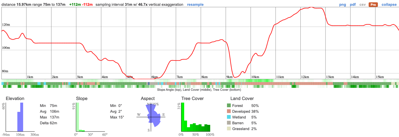
With one group camping up North this weekend, we're also running a local adventure, led by Sarah that's totally accessible by public transport. We're visiting a part of the city that few ever get out to - pretty crazy because it's some of the most picturesque hiking that's close to town. We'll take in ravines, creeks, woods and end up at a graveyard to Toronto monuments for a 15km hike. Know what else you're likely to see? Salmon! Highland Creek gets plenty of them swimming up stream and we'll be visiting at the perfect time
The day starts and ends at at Guild Park, accessible by TTC from town. We'll begin the hike by getting up into Highland Creek where we'll follow the river for about 8km, winding our way through parks, ravines and woods. We eventually come out at the waterfront, taking in a couple of incredible views of the lake and city before ending up at Guild Park, home of Toronto's demolished building facades. Walking through the park you'll see the old frontages of once iconic buildings that have now been lost to history.
From there, you can either return by car or catch the TTC back to the city.
This is a long hike but one on well marked trails and without too much elevation. Expect it to take about 7hrs to complete.
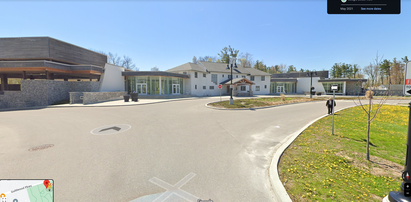
10:00 - Meet with self drivers at Guild Park. There's plenty of free parking and we'll meet out front of the estate as pictured.
10:00 - Begin Hike, eat lunch en route
16:30 - Anticipated end
17:30 - Anticipated return to Toronto
This custom map is georeferenced, meaning it will show you where you are on the map in the right software and lays out the rough path that we’ll be following. It’s opened with the Avenza app which must be downloaded and installed in advance of the adventure.
You should also download the What3words app - this makes it easy to share and find locations in the unlikely event that you get lost.
We like to share some of the indigenous background of the areas we visit because these territories have rich histories that are easy to overlook. Indigenous communities have a connection to and respect for the land that has largely been lost since European settlement. As we strive to form a deeper connection with the land, we have much to learn from these communities. You can use the Native Land map to learn more about these areas.
Toronto has a particularly long and varied indigenous history, groups who maintain connections to the land include:
With one group camping up North this weekend, we're also running a local adventure, led by Sarah that's totally accessible by public transport. We're visiting a part of the city that few ever get out to - pretty crazy because it's some of the most picturesque hiking that's close to town. We'll take in ravines, creeks, woods and end up at a graveyard to Toronto monuments for a 15km hike. Know what else you're likely to see? Salmon! Highland Creek gets plenty of them swimming up stream and we'll be visiting at the perfect time
The day starts and ends at at Guild Park, accessible by TTC from town. We'll begin the hike by getting up into Highland Creek where we'll follow the river for about 8km, winding our way through parks, ravines and woods. We eventually come out at the waterfront, taking in a couple of incredible views of the lake and city before ending up at Guild Park, home of Toronto's demolished building facades. Walking through the park you'll see the old frontages of once iconic buildings that have now been lost to history.
From there, you can either return by car or catch the TTC back to the city.
This is a long hike but one on well marked trails and without too much elevation. Expect it to take about 7hrs to complete.
10:00 - Meet with self drivers at Guild Park. There's plenty of free parking and we'll meet out front of the estate as pictured.
10:00 - Begin Hike, eat lunch en route
16:30 - Anticipated end
17:30 - Anticipated return to Toronto
This custom map is georeferenced, meaning it will show you where you are on the map in the right software and lays out the rough path that we’ll be following. It’s opened with the Avenza app which must be downloaded and installed in advance of the adventure.
You should also download the What3words app - this makes it easy to share and find locations in the unlikely event that you get lost.
We like to share some of the indigenous background of the areas we visit because these territories have rich histories that are easy to overlook. Indigenous communities have a connection to and respect for the land that has largely been lost since European settlement. As we strive to form a deeper connection with the land, we have much to learn from these communities. You can use the Native Land map to learn more about these areas.
Toronto has a particularly long and varied indigenous history, groups who maintain connections to the land include:
